Land Surveying in Milton Keynes
01908 767620
Measured Surveys, Boundary Plans, and Topographical Mapping
If you would like to request a quotation or discuss any land surveying requirements in Milton Keynes, please call us on 01908 767620 or complete the contact form below. One of our qualified surveyors will be pleased to assist.
David Cosby Chartered Surveyors provide a comprehensive land surveying service with clear, transparent pricing and no hidden fees. Established in 2003, our team combines professional surveying and legal expertise to support a wide range of residential and commercial property matters.
Land Surveyors for Milton Keynes and Surrounding Villages
We provide precise, dependable land surveying services to property owners, developers, architects, and legal professionals across Milton Keynes and the surrounding areas. Our firm has a long-standing reputation for accuracy and integrity, backed by RICS regulation and over two decades of experience.
Whether you require a boundary survey for legal purposes, a topographical survey for planning, or a Land Registry–compliant plan, our team combines advanced survey technology with detailed local knowledge to deliver clear, reliable results every time..
Trusted Surveyors Serving Milton Keynes Since 2003
David Cosby Chartered Surveyors are proud to have supported property professionals, homeowners, and developers in Milton Keynes since 2003. With detailed knowledge of the local area and specialist expertise in land measurement, boundary demarcation, and topographical mapping, we provide clear, reliable advice on a wide range of surveying matters. Every instruction is overseen by a qualified Chartered Surveyor and delivered in accordance with RICS professional standards.
RICS Chartered Surveyors Serving Milton Keynes
Accurate Surveys for Planning, Boundaries & Development
Milton Keynes Land Surveyors
![]()
Milton Keynes Land Surveyors
Why choose David Cosby?
PROFESSIONAL SERVICE
We are a RICS-regulated firm offering precise, reliable land surveying services. Our team combines surveying and legal expertise to support a wide range of requirements, from boundary disputes and planning applications to Land Registry–compliant plans.
COMPETITIVE FEES
We offer clear, fixed-fee quotations with no hidden extras — whether for topographical surveys, boundary plans, or measured building drawings for planning and design.
ADVANCED TECHNOLOGY
We use industry-leading Leica 3D laser scanning and GNSS equipment to ensure accurate, high-resolution results. All drawings are produced using AutoCAD and prepared in line with Land Registry and planning authority requirements.
Latest News and Projects

FRIENDLY SOCIETIES MEDICAL INSTITUTE – Northampton’s Forgotten Historic Buildings
Standing alone on the side of the dual carriageway and covered in vine is another one of Northampton’s Forgotten Historic Buildings – the Friendly Societies Medical Institute.

Dry Rot
Dry Rot is one of the more damaging types of fungus but, fortunately, is also one of the more easily identifiable. Some of the main characteristics of Dry Rot have been set out in this short article.
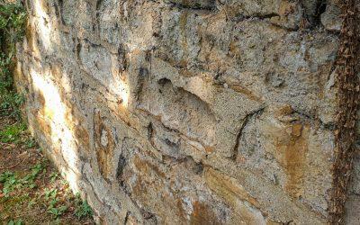
Northamptonshire Sandstone – Mortar Joints and Erosion
Northamptonshire sandstone with its deep orange hues is a beautiful building material that has been used in the county since Saxon times. It is, however, a relatively soft stone and is often severely damaged by inappropriate modern cement repointing works.
Don’t take our word for it:
Book A Free Market Appraisal


