
From Rope Stretchers to Satellites:
A Brief History of Land Surveying
Land surveying can look like a thoroughly modern occupation: tripods on pavements, instruments quietly rotating, and surveyors capturing data on tablets. But land surveying is an ancient practice. The tools have changed dramatically over time; the underlying purpose has not. A professional land survey is still about measuring land carefully enough that other people can rely on the result.
Before “surveying” was a profession
Long before surveying became formalised, people needed to divide land, align buildings, and establish straight lines. Early surveyors relied on ropes, rods, and sighting techniques, supported by geometry rather than technology.

A well-known example is Eratosthenes, who is credited with estimating the circumference of the Earth more than two thousand years ago. Using nothing more than sticks, shadows, and distance, he compared the angle of the sun at two locations and applied straightforward geometry to reach a result that was remarkably close to modern measurements. It is a neat reminder that surveying has always depended as much on method and understanding as it has on equipment.
The age of the chain
For centuries in Britain, land measurement meant chains. The most widely used was Gunter’s chain, introduced in the seventeenth century, which allowed distances to be measured consistently and recorded in acres, roods, and perches.
Chain surveying was demanding work. Keeping the chain straight, level, and properly tensioned over uneven ground required care and experience. Small errors could easily accumulate across a long measurement. Even so, chain surveys shaped much of the rural landscape we still recognise today, and many historic plans clearly reflect the practical limits of the method.
When optics changed the game
The development of optical instruments marked a major step forward. The introduction of the theodolite allowed angles to be measured accurately, making triangulation more reliable and enabling larger areas to be surveyed with greater confidence.
By the nineteenth century, surveying had become a recognised profession, supported by improved instruments, better training, and more consistent standards. Measurement was still manual, but accuracy improved significantly.
Electronics, total stations, and laser scanning
The twentieth century brought electronic distance measurement, replacing chains and tapes with light- and radio-based systems. Modern total stations combine distance and angular measurement in a single workflow, transforming what once took days into work that can often be completed in hours.
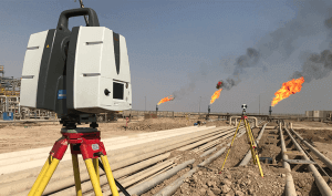
More recently, laser scanning has changed how complex sites and buildings are recorded. Instead of capturing individual points, scanners record millions, producing detailed three-dimensional point clouds that are invaluable for refurbishment, heritage work, and sites with awkward geometry. Satellite-based positioning has also become central to surveying larger or more open sites where a robust control network is required.
The part technology does not replace
Despite all this progress, the equipment does not do the job on its own. A scanner will record everything it can see, whether it is relevant or not. A satellite receiver will provide positions, but it will not decide which features matter, whether something looks inconsistent on site, or whether the results make sense in context.
Good land surveyors still rely on professional judgement: knowing what to measure, what to check, and how the data should be interpreted.
Commissioning a land survey
If you are planning design work, dealing with a complex site, or simply need measurements you can rely on, commissioning the right land survey at the outset is a sensible investment. Clear, accurate survey data reduces uncertainty, avoids abortive work, and gives designers, engineers, and solicitors a solid foundation to work from.
And whilst a couple of our surveyors are now in their later years, we have thankfully moved on from measuring with sticks and chains. We pride ourselves on combining long experience with modern surveying equipment and up-to-date methods, delivering accurate, dependable survey data that can be relied on with confidence.

